Access to Kersik
Luwai National Park
Kersik Luwai National Park can be reached overland by Bus from
Samarinda to Melak, or by air from Balikpapan / Samarinda to Melak
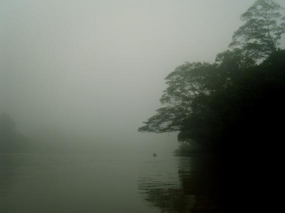
village. More attractive is the boat cruise upstream Mahakam River.
From Melak Village it is about 1 hour by chartered car to Kersik Luwai
Reserve.
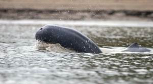
Muara Pahu a small village a bit downstream from Melak has a Fresh
Water Dolpin Information Center (RASI).
Accommodation
Some Guesthouses and Hotels can be found in Melak village.
|
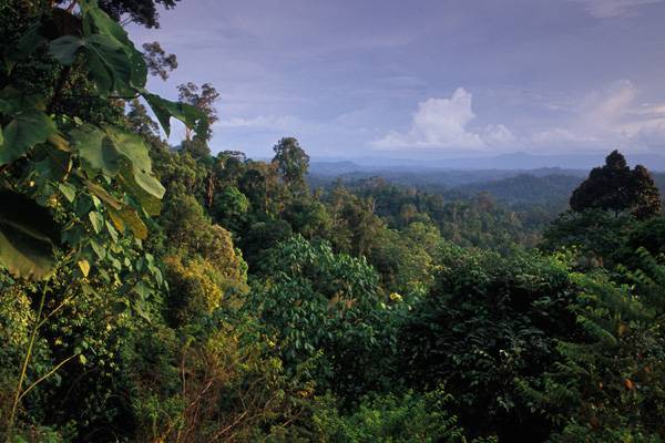
Kersik Luwai National
Park
Kersik
Luway National Park is nature
reserve between Melak and Barong Tongkok, 18 kilometers to the south.
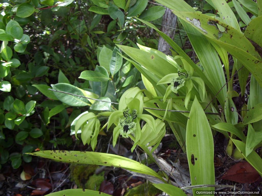
The "Black Orchid" (Coelogyne pandurata) which blossoms usualy between
April
and December, grow's on shrubs in this 5,000 hectare reserve. More
then hundred of wild and rare orchid
species grow in this forest. Several Rare Pitcher Plants can
also be found at Kersik Luwai National Park. The reserve is
located north of Samarinda and can be reached in 20
hours by
boat upstream Mahakam River. Other tourist attractions in this region
are Jentur Gemuruh
waterfall and Eheng Longhouse, where 35 familes of the Dayak Tunjung
Tribe live in their traditional way.
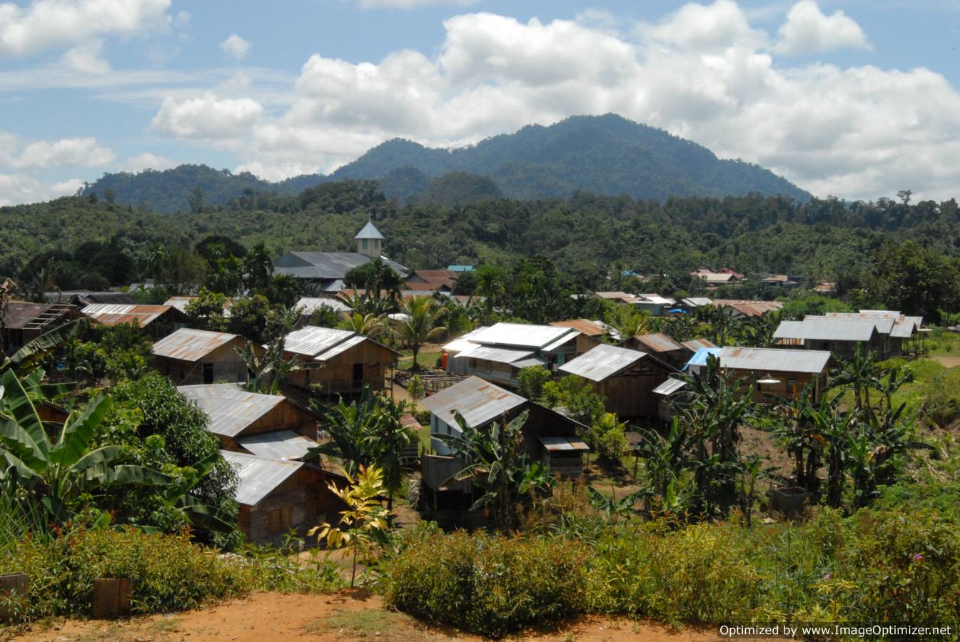
Visitors usually stay at Sekolag Darat village. Pepas Eheng village
belongs to the Barong Tongkok district.
Plait work, rattan furniture and Tunjung Dayak statues are made here.
The village can be reached from Melak in one hour by car. Muara Oahu is
a district town at the meeting point of the Kedang Pahu and Lawa river,
in the Mahakam hinterland. Twenty-eight villages, with a total
population a bout 11,000 are found in this area. The cultural heritage
of the Dayak people is very much evident at Tolan village. There are
two traditional houses and a graveyard which are worth seeing. The
people here live from panning for gold, looking for bird's nests and
tilling the dry fields.
|
Mahakam River
Cruise Trips
into the Heart of Kalimantan
 The
Fascinating Mahakam River at Indonesia Borneo Island is
a intriguing history of
Sultan Kingdoms and traditional Dayak Tribes, with a wealth of
ecological and cultural treasures that
survive deep within the rainforest jungle of Indonesia ’s
largest island. It's the highway into Kalimantan ’s dense
jungle where you can discover the rich Dayak Culture and their
Longhouses. The grand
diversity of exotic flora and wildlife from black orchids to fresh
water dolphins and orangutans give you an unforgettable trip at East
Kalimantans. The
Fascinating Mahakam River at Indonesia Borneo Island is
a intriguing history of
Sultan Kingdoms and traditional Dayak Tribes, with a wealth of
ecological and cultural treasures that
survive deep within the rainforest jungle of Indonesia ’s
largest island. It's the highway into Kalimantan ’s dense
jungle where you can discover the rich Dayak Culture and their
Longhouses. The grand
diversity of exotic flora and wildlife from black orchids to fresh
water dolphins and orangutans give you an unforgettable trip at East
Kalimantans.
MAHAKAM
RIVER
The
Mahakam River is the most important traffic route in
East-Kalimantan. Between the spring in the mountains and the delta
along the coast, the river measures somewhere 1.000 kilometers. In
between several big rivers mouth in the Mahakam River. Big ships use
the big river system until the highlands, where rapids eventually make
any progress impossible; from there “longboats” (
big canoos with
motors) are used.
UPPER
MAHAKAM RIVER
The
Mahakam springs in the 1500 to 2000 meter high Müller Range,
not too far from the border with Sarawak. Before streaming down about
100 kilometers to the first Dayak village, Long Apari, three
side-rivers - Apari, Hubung and Kasau - join the Mahakam. After several
dozen small mountain villages, the river falls down about 150 meters
through several dangerous rapids. Besides several noisy longboat there
is no other traffic here.
The Dayak along the Upper-Mahakam mainly live from agriculture ( ladang
cultures ). Incidental income are gained from birds nests, ratten and
washed gold. Because of the hard and dangerous transport through the
rapids, basic goods are extensively expensife. Every once in a while a
canoo turns upside down: the valuable goods are lost and sometimes also
their even more expensife motors. People also get drowned regularly.
MIDDLE
MAHAKAM RIVER
The
village of Long Bagun, on threehundred kilometers from the
spring of the Mahakam, is the final destination of traffic on the
river, besides several longbot. The river reaches the small city of
Long Iram through several more than 150 km long valleys, this is the
final destination of the organised, heavy traffic. A big part of the
year, smaller ships will continue the trip to Long Bagun, but a period
of drought in the hinterlands can cause the waterlevel to drop very
fast and make traffic impossible.
COAST
& DELTA OF THE MAHAKAM RIVER
After
Long Iram, the river widens. The brown water turns through
the endless lowlands to the sea. Slowly the small villages are replaced
by small cities. Through the sky, the distance between Long Iram and
Samarinda is about 175 kilometers but over water it's about twice that
distance.
Near Muara Pahu, where a big side-river flows in the Mahakam, the
hungry traveller is welcomed by a long row of food stalls. Several
hours downstream, the river lingers between four big lakes. After that
is streams towards the north to meet it's most important side rivers
near Muara Kaman, the Kedang Kepala and Belayan.
Most boats will stop for a dinner on Senoni, about 30 km downstream
from Muara Kaman. Sometimes there is cold beer or river lobster; after
a visit to the inlands, Senoni is the place to be for a culinair trip.
Near Tenggarong, the governmental center of the Mahakam beaken, the
river becomes a crowded traffic route for ships in all kinds and sizes.
This lively crowd is kept until Samarinda, where the seaworthy ships
make themselves ready for departure to Makassar Strait, 60 km to the
east. |
©
PT.Gigantara 2007-2014
X-TREME
BORNEO Jl.Martadinata Rauda 1 no 21 Samarinda - East Kalimantan -
Indonesia Phone + 62 8125846578 Fax :+62 541
7778648
JOIN US FOR A ONCE IN A LIFE
TIME EXPLORATION OF THE NATIONAL PARKS AT KALIMANTAN ISLAND
|